
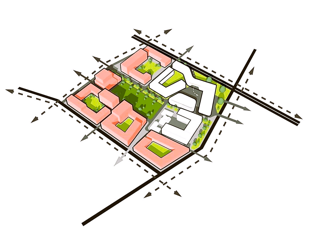
Urban Massing
Generating optimised urban forms and structures through procedural algorithms and parametric modelling.
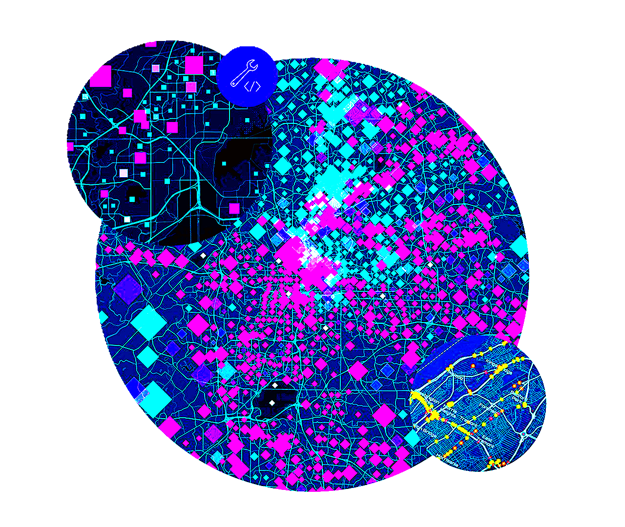
Spatial Analytics
Uncovering hidden patterns from geospatial data — point clouds, rasters, and vector networks — to inform critical decisions.

Urban Informatics
Harnessing data science, machine learning, and real-time sensing to decode complex urban systems.
Mukesh Yadav

"Transforming landscapes through the power of geospatial data science"
I'm a GIS Analyst & Solution Engineer with extensive experience in the ArcGIS Enterprise ecosystem, focused on addressing challenges for State and Local Governments. I connect public sector needs—like urban planning and climate resilience—with innovative spatial technology. My expertise in technical demonstrations and Proofs of Concept (PoCs) highlights my commitment to excellence. I'm excited to provide presales support and system architecture design to help organizations harness the power of location intelligence!
Tech Stack
Projects
Select a project to view technical details and launch the application.

World Population Explorer
Explore global population trends and demographics through interactive geospatial visualization.

Urban Insights
Unlock spatial patterns and urban morphologies using advanced geospatial analytics.

Climate Change Analyser
Analyse climate change patterns, risk models and environmental impact at scale.
Urban Planning Tool
Plan, model and visualise urban development projects with procedural generation.
Precision-Agri
Analyse crop health, yield forecasts and fertiliser optimisation with satellite data.
Publications

Mapping Urban Green Spaces: The Spatial Revolution for 15-Minute Cities
Unlocking the Potential of Urban Green Spaces with Multispectral Imagery and Spatial Analytics
Read Article →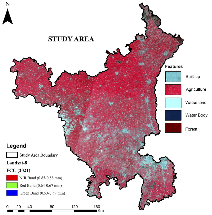
Estimation of soil erosion in indo-gangetic region using revised universal soil loss equation (RUSLE) model and geospatial technology
This study estimates potential and actual soil erosion in Haryana using the RUSLE model integrated with geospatial technology, revealing critical insights for conservation planning.
Read Article →